
Walk a Sahuarita Street Directory
A sound search runs from place to proof. Begin with the complete street number and standardized street name. Pima County may return an address point, a tax parcel, or several premises tied to one parcel. Capture the tax code and jurisdiction before drawing any conclusion about an owner. Then compare the Assessor record with the map and the deed. Use voter or directory material only when its access rules and dates fit the question.
- Validate the address in PimaMaps or the Assessor and note the tax code, situs address, jurisdiction, and subdivision clues.
- Move along the same road in PimaMaps. Open each parcel rather than assuming that house numbers are complete or sequential.
- Read the Assessor card for the named owner or taxpayer, mailing destination, parcel history, and available images.
- Use the present acquisition record to enter the Recorder index, then match the legal description before following a seller backward.
- For lawful, authorized research, consult the voter-file channel or dated reverse directories without treating either as a full household roll.
This street-by-street flow leaves an audit trail. It also shows where a claim stops. An ownership record can name title holders. Only separate, dated evidence can support a claim that a person actually lived there.
Search Sahuarita Streets by Address
The free Pima County Assessor Advanced Search is the strongest first pass for the Sahuarita street directory. Its main search accepts a parcel, address, or owner name. Advanced routes add map and plat, recorded document number, Public Land Survey System location, and subdivision name. A parcel page may expose Genealogy, History, Images, and a tax-year selector. Those paths help reconcile an address with the county's tax code and land description.
| Search control | Kind | Use in a street search | Key caution |
|---|---|---|---|
| Parcel, Address, or Name | Unified text box | Start with a full street address or tax code | No field is marked as required |
| Advanced Search | Search mode | Try owner, address, plat, document, PLSS, or subdivision | Carry exact spelling between systems |
| Select Tax Year | Selector | View another available assessment year | Availability varies by parcel |
| Genealogy, History, Images | Detail tabs | Check past tax context and parcel documents | Tax history is not an occupant list |
The captured Assessor address-search screen shows the official entry point used for this step.

The screen anchors a by-address search in a county source rather than a compiled name list.
Map Sahuarita Street Parcels
PimaMaps turns one valid address into a street view of nearby parcels. General Search accepts a parcel number, address number, street, intersection, full address, or owner. Click a feature for its pop-up and More Information path. Layers cover streets, parcels, aerial images, annexations, plats, transportation, flood features, and other county data. Identify and Measure can snap to mapped features, while a query can be saved or exported.
The PimaMaps street and parcel viewer was captured for a close look at that map-based workflow.
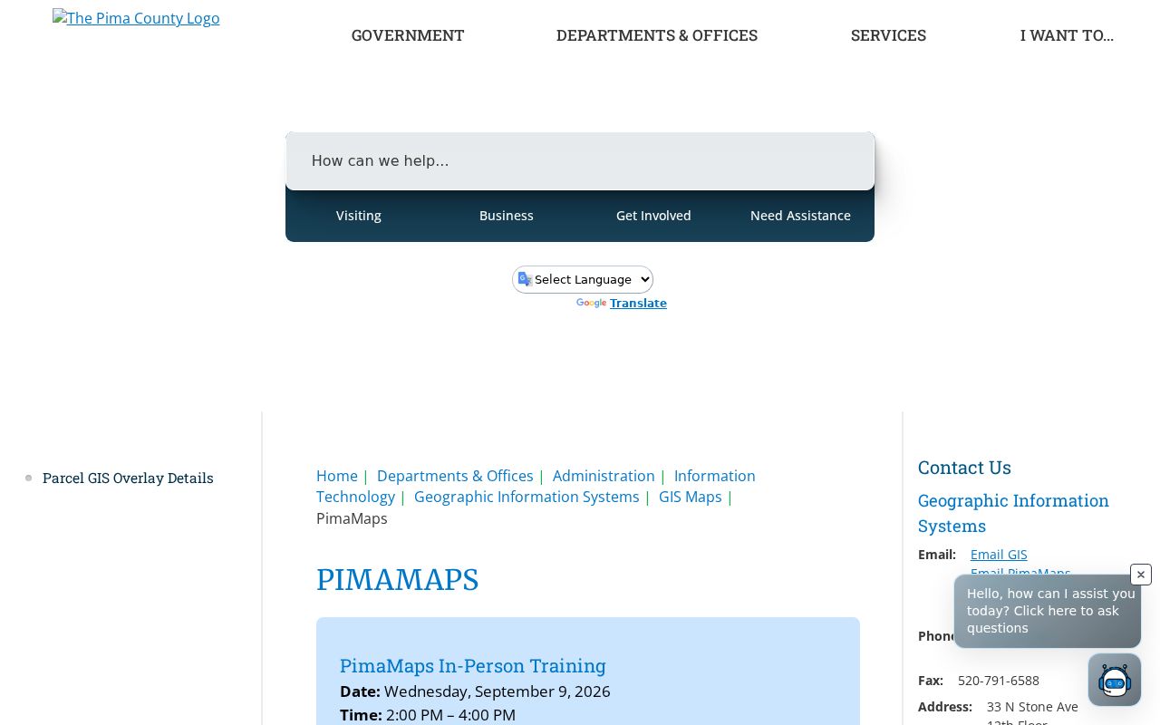
The map helps a researcher move parcel by parcel, but its parcel fabric is for planning and relationships. It is not a boundary survey or proof of title.
PimaMaps can also open aerial context and export an image, GeoTIFF, or PDF. That is useful for documenting which parcels were reviewed. Empty ground, shared tax codes, and mobile-home layouts can break a neat house-number sequence, so each tax code still needs its own Assessor check.
Note: A mapped shape can share another feature's tax code, so never infer separate ownership from its outline alone.
Sahuarita Street Records by Source
No single roll supplies a full Sahuarita street directory. Each address-keyed source adds one part of the record, and every channel has a limit. The table separates title, tax, map, permit, voter, and historical evidence.
| Street-linked source | Official keeper | What it adds | Access and limit |
|---|---|---|---|
| Parcel and tax roll | Pima County Assessor | Owner, tax code, situs, mailing destination, value, traits | Free search; not a household roster |
| Parcel geometry | Pima County GIS | Adjacent land, streets, jurisdiction, aerial context | Free viewer; not a survey |
| Recorded instruments | Pima County Recorder | Grantors, grantees, deeds, liens, releases, legal descriptions | Web index, counter, and mail-copy routes |
| Tax account | Pima County Treasurer | Billed, due, and paid status | Free property inquiry; parcel is best key |
| Permit and address record | Town or county agency with jurisdiction | Validated address, work, inspection, and date clues | Coverage depends on place and period |
| Voter file | Pima County Recorder | Limited residence data for authorized statutory uses | Paid request; protected people and nonvoters absent |
| Reverse directory | Library or archive | Dated occupant entries by street where a local run exists | Sahuarita-specific coverage is not confirmed |
Use the parcel number to link tax and map records. Use the legal description and recording reference to test deeds. A person or street name alone creates same-name and spelling risks.
Read Sahuarita Address Data
Pima County's open address layer records more than the words printed on an envelope. It can include address ID, parcel, street number, direction, street name and suffix, jurisdiction, postal city, ZIP, edit date, and coordinates. The official Facility Addresses query lets a careful researcher inspect or export that standardized data.
The county address-data result is shown in the captured view below.
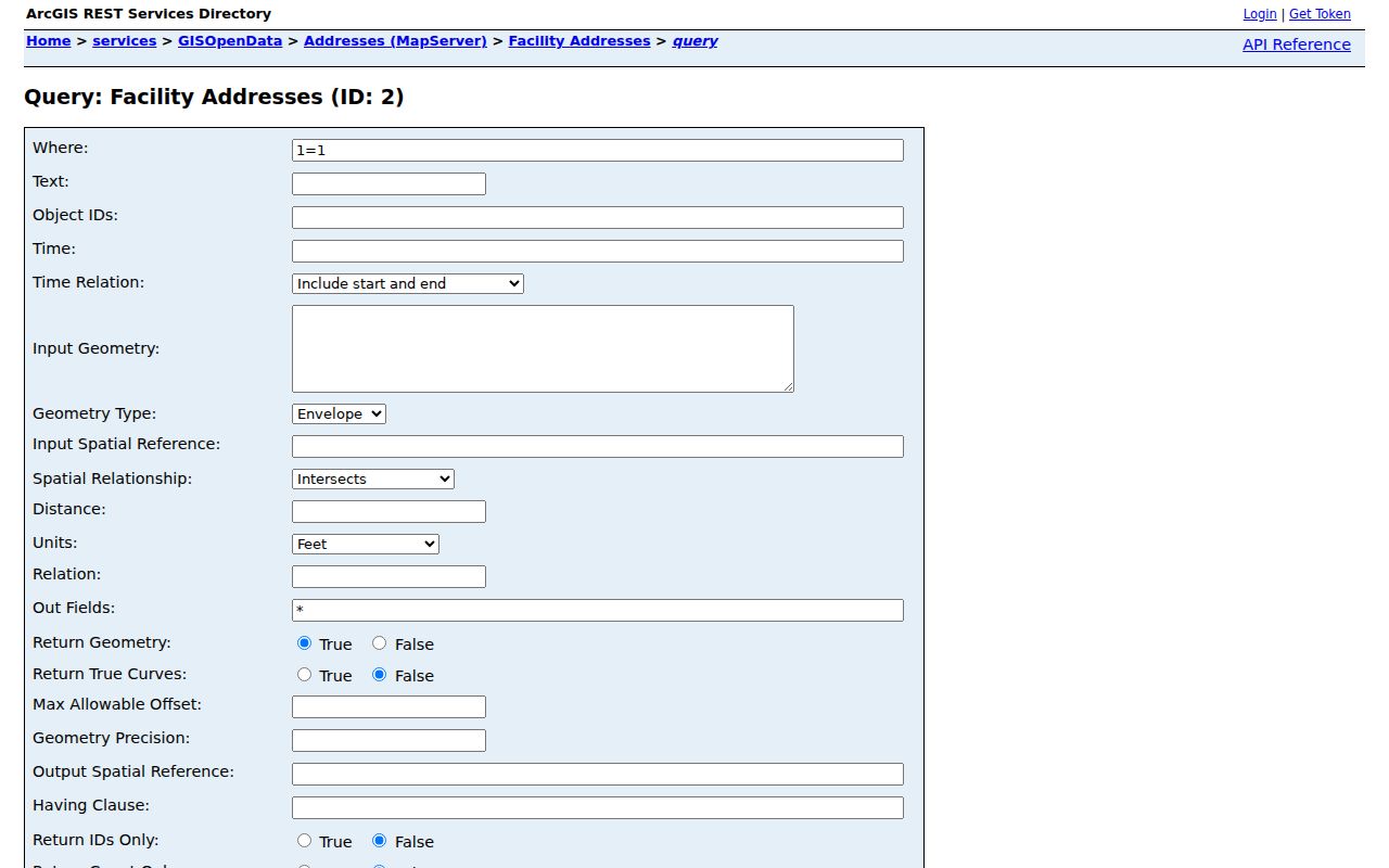
Those fields help translate a street label into the parcel and jurisdiction terms used by other record systems.
- Parcel
- A tax-mapped unit identified by a county tax code. One parcel may contain several premises.
- Situs address
- The address assigned to the physical property, unlike the owner's mailing destination.
- Plat
- A recorded map that identifies subdivision lots, blocks, streets, and easements.
- Criss-cross directory
- A dated directory arranged by street and house number instead of only by surname.
Sahuarita Streets Share Parcels
An official county example shows why street entries cannot be counted as one parcel per door. Parcel 303-78-8330 reports eleven premises on South Rancho Sahuarita Boulevard, including the base address and ten numbered units. Jurisdiction, postal city, and ZIP appear on the address detail, yet all of those premises connect to the same tax parcel.
The official multi-unit parcel record captures this local street-directory quirk.
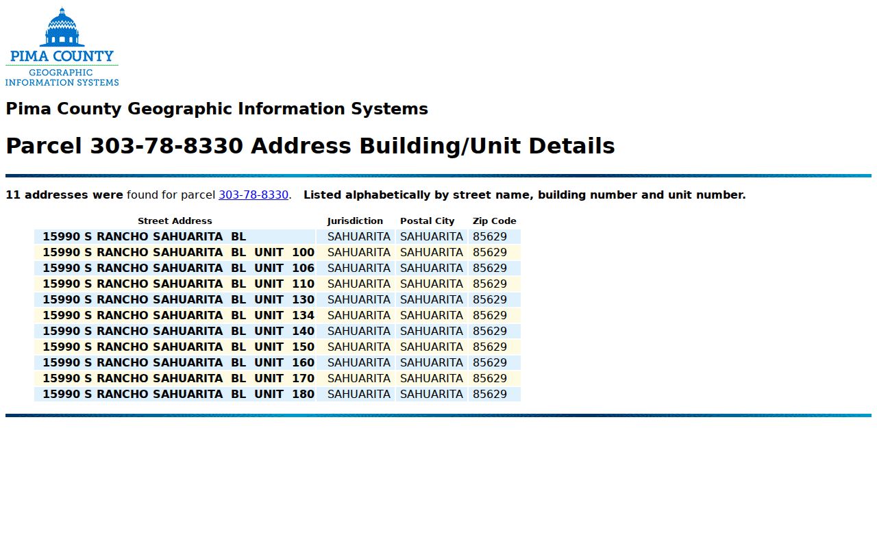
The example explains why a parcel owner cannot be assigned to each unit as its resident. Unit-level occupancy needs another lawful and date-matched source.
Can one parcel list many addresses? Yes. Buildings, commercial centers, mobile-home settings, and unit records can attach multiple premises to one tax code. Open the county's building and unit detail before counting addresses.
Follow Sahuarita Streets into Deeds
The Recorder preserves deeds, deeds of trust, releases, liens, affidavits, plats, and other land records. Begin with the owner spelling and acquisition clue found on the parcel record. In the Pima County recorded-document search, verify the land by legal description or recording reference. Then search the seller as an earlier buyer to move backward. The legal land description is the stable bridge when a road name, ZIP, or postal label has changed.
If the web index or image does not answer the question, use the Research and Recording counter at 240 N. Stone Avenue in Tucson. The Eastside office at 6920 E. Broadway Boulevard provides another limited-service channel. Mail copies go through the Recorder's listed post-office box. County research states that recorded books reach 1865 and all documents from June 1982 forward are indexed, while older indexing continues. Office computers bridge material not yet indexed online.
Web images are free and watermarked. Clean or certified copies follow the Recorder's purchase process. That difference matters when a street-directory clue must be supported with an official copy.
Check Sahuarita Street Permits
Permits can date work at a specific address and may name an applicant or contractor. First confirm which government held jurisdiction when the work occurred. Sahuarita incorporated in 1994, and annexations added areas in 1997, 1999, 2000, and 2018. A structure could remain in place while responsibility for later municipal records changed.
The Pima County Addressing resources include address validation, the Official Address Guide, street-name checks, a modified-address search, and change forms.
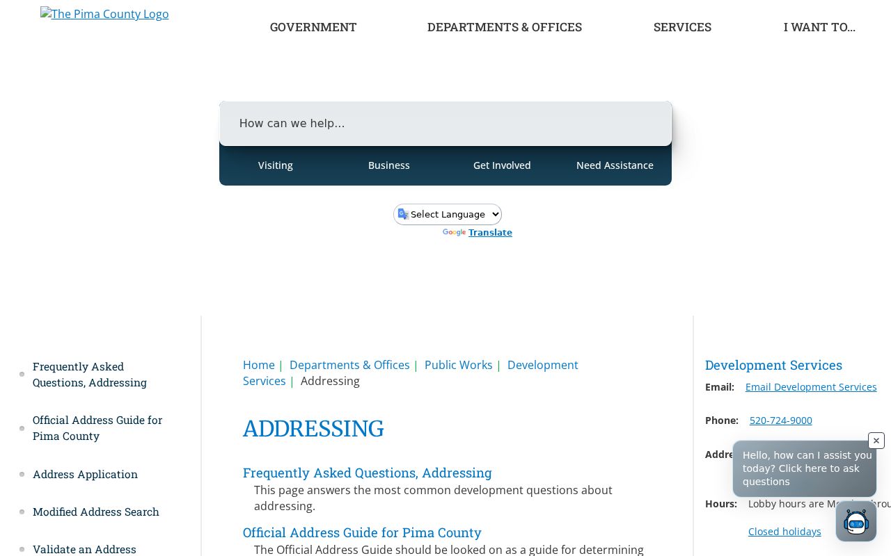
The captured page provides the regional vocabulary needed before a Town or county permit request is filed.
For a Sahuarita record that is not posted, use the Town public-records request channel under Arizona Public Records Law. State a precise address, record type, department, and date span. A narrow request helps the custodian distinguish a permit file from a broad parcel or planning search.
Sahuarita Street Labels Can Mislead
A postal city of Sahuarita does not prove that land lies inside the incorporated town. County address data can pair the 85629 mailing geography with either the Sahuarita jurisdiction code or unincorporated Pima County. The street directory must therefore read the Jurisdiction field, municipal boundary layer, and date of annexation separately from the postal line.
The same split affects records. Town permits and municipal files begin only when the Town had authority. County land, tax, Recorder, and court records remain the durable chain. If an old search fails, carry the parcel, legal description, subdivision, and standardized street components to the next source instead of treating the result as absence.
Note: The building may not have moved when annexation changed which office kept its later permit and municipal records.
Bridge Sahuarita Streets Through Time
A reverse or criss-cross directory can turn an old street number into a dated occupant name. Yet no Sahuarita-only run has been verified. The Pima County Public Library's broader Tucson-area directory holdings are the honest fallback, and gaps may reflect years that were not published or rental books returned to publishers. The full shelf and publication history belong to the Sahuarita historical city directory.
Pair any directory entry with deeds, Assessor history, permits, census records, newspapers, obituaries, or probate material. Each source marks a date, not an unbroken stay. The federal census is public through 1950 under its 72-year release rule, while land and local files use different time spans. A legal description can keep the research tied to one parcel through a street-name or postal change.
Limits of Sahuarita Street Lookups
A street directory built from official records cannot list every Sahuarita resident. Assessor records name owners or taxpayers, not all people at an address. Nonowner occupants, relatives, guests, and utility customers do not form an open household roll. Driver addresses are protected. Some voter addresses are sealed, and the public voter file has narrow statutory purposes under A.R.S. § 16-168.
The personal Arizona voter portal is for a voter to check their own status and election facts. It is not a by-street neighbor browser. A lawful public-file request through the Pima County Recorder has purpose, fee, and redistribution limits; voting history shows participation, never ballot choices.
Lawful use. Use Sahuarita address records only for legitimate personal research. Never use a street lookup to stalk, harass, threaten, or harm anyone.
Commercial people-finder compilations can merge stale addresses and same-name people. Treat that category as a lead at most. For a reliable street-by-street record, return to the agency that created the parcel, deed, permit, map, or authorized voter record and verify its date.